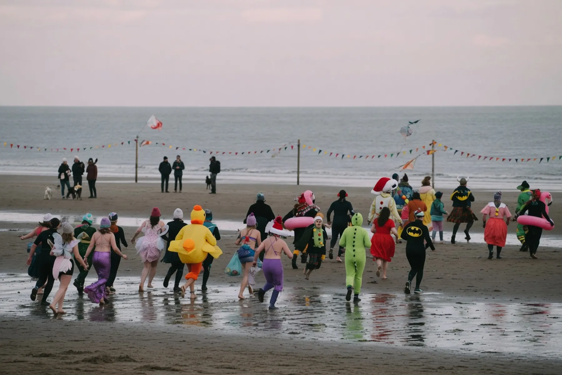
Pembrokeshire's best-known beaches are spread along three coasts.
In the south, Amroth and Saundersfoot are village beaches with promenades and cafés, Manorbier sits under its castle, and the National Trust's Stackpole bays, Barafundle and Broad Haven South, have a car park and a walk instead of a seafront; Freshwater West, further west, is a surf beach where the National Park calls bathing very dangerous. St Brides Bay has Marloes Sands, Broad Haven and Newgale, and the north coast has Whitesands near St Davids, slate-dark Abereiddi and Poppit Sands on the Teifi estuary.
Natural Resources Wales rated eleven of the twelve Excellent for bathing water in 2025; Amroth was rated Good. Seven had RNLI lifeguards in 2026, all of them through August, and Whitesands for longest, from the Easter holidays to the end of the October half-term. Barafundle, Broad Haven South, Marloes, Manorbier and Abereiddi have no lifeguards, so for a patrolled swim in high summer the picks are Saundersfoot and Broad Haven, both of which the RNLI describes as good for swimming.
Dogs decide it for many people. From 1 May to 30 September dogs are kept off the whole of Whitesands and off part of Saundersfoot, Amroth, Broad Haven, Newgale and Poppit; the other six here take dogs all year, and from 1 October every restriction lifts.
Lifeguards: the 2026 season. Water: the latest official bathing-water classification. Every fact links to the page it came from, checked 27 October 2026.
Summer dog ban Lifeguards in summer Good water (2025)
Half a mile of flat sand below a village seafront, with wooden groynes at the top of the beach and rock pools towards the western end, where the National Park says the cliffs are unstable and best avoided. The Pembrokeshire Coast Path starts or finishes here, and on the very lowest tides the stumps of a drowned forest sometimes show through the sand.
Surface
sand and shingle
Dogs
Banned from the central part of the beach in front of the village 1 May–30 September; allowed all year at both ends (west towards Wiseman's Bridge, east towards Pendine). Leads on the promenade and in the car parks in that period. Source
Lifeguards
Amroth's RNLI patrol in 2026 ran every day from 18 July to 6 September, 10am–6pm Source
Facilities
Two sets of public toilets (accessible and baby-changing facilities only in the block in the western car park); shops, cafés and pubs along the seafront Source
Access
Ramp beside the toilets (1:8 to 1:7, 45 m) that often ends in a drift of large pebbles; from Amroth Castle, away from the shops, a slipway (1:6 to 1:5.5, 44 m) leads on to the sand; the concrete esplanade runs the whole seafront Source
Parking
Car park for about 60 cars (seasonal charges) plus parking along the sea wall; the rest of the seafront is Blue Badge only Source
Tides
The lowest tides occasionally uncover the stumps of a submerged forest; the National Park warns that currents can be unpredictable, especially at low tide Source
Water quality
Good in 2025, the Natural Resources Wales's classification for Amroth Central. Source
Summer dog ban Lifeguards in summer Excellent water (2025)
A resort beach of broad, flat sand in front of the village and its small harbour, with cafés, pubs and shops a few steps away. The RNLI describes shallow water that suits swimming, and the old tramway path runs along the shore through tunnels to Coppet Hall and Wiseman's Bridge.
Surface
sand
Dogs
Banned 1 May–30 September from the main beach in front of the village, from the harbour north towards Coppet Hall; allowed all year on the stretch nearest the tunnel to Coppet Hall and on the beach south of the harbour towards Tenby. Leads on the promenade and in the car parks in that period. Source
Lifeguards
Saundersfoot's RNLI patrol in 2026 ran every day from 4 July to 6 September, 10am–6pm Source
Facilities
Toilets, cafés, pubs, restaurants and shops in the village; an ice-cream van on the beach; harbour and slipway Source
Access
Concrete slipway at the north end (36 m, mostly no steeper than 1:12 but 1:6 to 1:5 for 13 m in the middle); a zigzag ramp at the end of the harbour reaches Glen beach; a beach wheelchair is available for hire Source
Parking
Two big options: the privately run harbour car park, or the National Park's car park 200 m back from the sand Source
Tides
Wide and flat at low tide, with sand left to sit on at high tide Source
Water quality
Excellent in 2025, the Natural Resources Wales's classification for Saundersfoot. Source
Dogs allowed No lifeguards Excellent water (2025)
A sandy bay with a pebble bank and dunes, a stream at its northern end and Manorbier Castle on the slope above. It faces south-west and catches surf, and Visit Pembrokeshire warns of very strong currents; there are no lifeguards.
Surface
sand and shingle
Dogs
Dogs welcome all year: the beach does not appear on the council's summer (1 May–30 September) dog-ban list Source
Lifeguards
No RNLI lifeguards: the beach is not on the RNLI's list of lifeguarded beaches (checked 27 October 2026) Source
Facilities
Toilets, a telephone and an ice-cream van at the beach, with several cafés and a pub up in Manorbier itself Source
Access
The path to a viewing platform and bench above the beach is level but rough-surfaced, ending in three short slopes (up to 1:10) over its last 40 m Source
Parking
National Park car park with 30 spaces, and 10 more spaces along the coast towards Freshwater East Source
Water quality
Excellent in 2025, the Natural Resources Wales's classification for Manorbier. Source
Dogs allowed No lifeguards Excellent water (2025)
A sheltered, east-facing bay of fine sand with dunes and pine woods behind it, on the National Trust's Stackpole Estate and reachable only on foot. Nothing is provided on the beach, so it suits people prepared to carry in what they need and carry everything back out.
Surface
sand
Dogs
Allowed all year (National Trust, dogs under close control) Source
Lifeguards
No lifeguards Source
Facilities
None on the beach; toilets (including accessible and baby-changing) and the Boathouse tearoom are at Stackpole Quay Source
Access
Half a mile on foot from the Stackpole Quay car park along the coast path, including steep steps down to the sand; the National Park does not list it as an easy-access beach and points to Broad Haven South instead Source
Parking
National Trust pay-and-display car park at Stackpole Quay, charged dawn to dusk every day; NT members and Blue Badge holders park at no charge Source
Water quality
Excellent in 2025, the Natural Resources Wales's classification for Barafundle. Source
Dogs allowed No lifeguards Excellent water (2025)
A wide bay of soft sand backed by dunes, with the limestone stack of Church Rock offshore and the stream from the Bosherston lily ponds running across the beach. Walking in from Bosherston through the lily ponds makes a longer outing of it, but there are no lifeguards and Visit Pembrokeshire warns of strong currents.
Surface
sand
Dogs
Allowed all year Source
Lifeguards
No lifeguards Source
Facilities
Toilets with accessible facilities (no baby changing) in the Broad Haven South and Bosherston car parks; an ice-cream van above the beach; pub and café in Bosherston Source
Access
A steep path from the car park above the beach; the National Park's easy-access route is the one-mile boardwalk from the Bosherston car park through the lily ponds Source
Parking
National Trust pay car parks above the beach and in Bosherston Source
Tides
A big spread of soft sand at low tide, when small caves also show in the low cliffs on the east side Source
Water quality
Excellent in 2025, the Natural Resources Wales's classification for Broad Haven (South). Source
Dogs allowed Lifeguards in summer Excellent water (2025)
A long, south-west-facing surf beach backed by a large dune system, used for filming Harry Potter and the Deathly Hallows and Ridley Scott's Robin Hood. Its waves are the best in the county for experienced surfers, but rip currents are strong, there is quicksand among the rocks at the southern end and the National Park calls bathing very dangerous: a beach to surf or watch rather than swim.
Surface
sand
Dogs
Allowed on the beach all year (National Trust land; dogs under close control) Source
Lifeguards
Freshwater West's RNLI patrol in 2026 ran every day from 20 June to 6 September, 10am–6pm Source
Facilities
Toilets at the beach car park Source
Access
Easiest from the car park by the toilets, down a concrete ramp (1:10 to 1:9 for 54 m) where shifting sand can leave a step at the bottom Source
Parking
Free National Trust car park by the beach, open dawn to dusk; no overnight parking or camping Source
Water quality
Excellent in 2025, the Natural Resources Wales's classification for Freshwater West. Source
Dogs allowed No lifeguards Excellent water (2025)
A long, remote beach under cliffs of exposed rock strata, which split it into a run of small bays as the tide drops, with Gateholm, a tidal island, at the western end. It is a walk from the National Trust car park, with nothing on the sand and no lifeguards; the National Trust describes it as a safe, sandy beach for bathing.
Surface
sand
Dogs
Allowed all year under close control (National Trust). Seals and their pups use the peninsula's beaches from late summer to mid-November: keep dogs on a short lead and at least 20 m away from them. Source
Lifeguards
No RNLI lifeguards: the beach is not on the RNLI's list of lifeguarded beaches (checked 27 October 2026) Source
Facilities
None on the beach; toilets and the Runwayskiln café are on the track between the car park and the beach Source
Access
On foot from the National Trust car park, half a mile from the beach Source
Parking
National Trust car park (cars £4 up to 3 hours or £8 all day as listed in October 2026; free for members, Blue Badge holders and motorbikes); charged dawn to dusk every day, no overnight parking Source
Tides
At high tide the beach can disappear altogether, so check the tide table before walking down Source
Water quality
Excellent in 2025, the Natural Resources Wales's classification for Marloes Sands. Source
Summer dog ban Lifeguards in summer Excellent water (2025)
The village beach of Broad Haven on St Brides Bay: west-facing, narrow and partly pebbly at high water but a wide sweep of firm sand at low tide, with cafés, pubs and watersports hire along the front. The RNLI notes the safe bathing that makes it popular with families, and the cliffs at either end draw geologists and rock-poolers.
Surface
sand
Dogs
Banned from the northern third of the beach 1 May–30 September; the rest of the beach is open to dogs all year. Leads on the promenade and in the car parks in that period. Source
Lifeguards
Broad Haven's RNLI patrol in 2026 ran every day from 4 July to 6 September, 10am–6pm Source
Facilities
Toilets with accessible and baby-changing facilities in the southern car park, and accessible toilets in the northern one; cafés, pubs, a shop and surf hire on the front Source
Access
Best from the southern end down a concrete slipway (1:12 to 1:7 for 29 m, steepest at the bottom); a ramp at the northern car park (1:12 to 1:9, then 1:5 for 3 m) can be pebbly at the base; esplanade along most of the front Source
Parking
Two car parks with up to 200 spaces between them; the smaller one on the seafront fills very quickly Source
Tides
Check the tide before going round the headland north of the beach to the sea stacks (Den's Door, the Sleek Stone): it is easy to get stranded Source
Water quality
Excellent in 2025, the Natural Resources Wales's classification for Broad Haven (Central). Source
Summer dog ban Lifeguards in summer Excellent water (2025)
Nearly two miles of sand at the head of St Brides Bay, backed by a high bank of pebbles thrown up by a storm in 1859. Surfing and kitesurfing are the draw, with a shop offering lessons and board hire at the northern end; at the far southern end there is a walk-through cave and a string of sheltered bays.
Surface
sand and shingle
Dogs
Banned 1 May–30 September from the middle section of the beach between the two lifeguard flagpoles; allowed all year at the northern end (by Newgale Shop and the kitesurfing area) and the southern end. Leads on the pebble bank and in the car parks. Source
Lifeguards
RNLI lifeguards at Newgale Central, 10am–6pm, in the 2026 season: May half-term (23–31 May), weekends 6–14 June, then daily 20 June–6 September. Newgale South had a separate daily patrol 4 July–6 September. Source
Facilities
Toilets; a surf shop, café and pub at the northern end; a café/beach shop and toilets at the southern end Source
Parking
Three car parks along the length of the beach, two of them pay and display Source
Tides
At very low tide it is possible to walk round to Cwm Mawr beach, but only with the tide times in hand; it is easy to be cut off Source
Water quality
Excellent in 2025, the Natural Resources Wales's classification for Newgale. Source
Summer dog ban Lifeguards in summer Excellent water (2025)
Porth Mawr: a wide bay of pale sand under the crag of Carn Llidi, west of St Davids, curving north to the rocks of St Davids Head. One of the best-known surf beaches in Wales and very popular, with the surf break at the northern end, where RNLI lifeguards pulled swimmers out of rip currents in May 2026; the southern end has quieter coves.
Surface
sand
Dogs
Banned from the whole beach 1 May–30 September, with leads on the promenade and in the car parks in that period; allowed from 1 October to 30 April Source
Lifeguards
Whitesands RNLI patrol, 10am–6pm, in the 2026 season: Easter holidays 28 March–12 April, weekends and bank holidays 2–17 May, daily 23 May–6 September, weekends 12 September–18 October, and daily for October half-term, 24 October–1 November Source
Facilities
Café, shop and toilets by the car park; picnic tables and a viewpoint on the level area in front of the surf life saving club; beach wheelchair hire Source
Access
A steep concrete ramp (1:5 to 1:4.5 for 17 m) on to the sand; changing sand, especially in winter, can leave a step at its foot Source
Parking
A private car park for 60 cars above the beach, which struggles in high summer; the Celtic Coaster shuttle (summer only) runs from the Oriel y Parc car park in St Davids Source
Water quality
Excellent in 2025, the Natural Resources Wales's classification for Whitesands. Source
Dogs allowed No lifeguards Excellent water (2025)
A small north-coast beach of dark slate sand and pebbles, where tiny graptolite fossils turn up among the stones. A path runs past ruined quarry cottages to the Blue Lagoon, a flooded slate quarry used for coasteering, which the National Trust has closed until Saturday 7 November 2026 to protect grey seals and their pups. The National Park warns of currents and undertow, and there are no lifeguards.
Surface
sand and shingle
Dogs
Allowed all year Source
Lifeguards
No lifeguards Source
Facilities
Toilets (no accessible or baby-changing facilities); a mobile kiosk sells refreshments in the car park; no litter or dog bins, so take rubbish home Source
Access
No easy access to the beach itself, but a wheelchair-accessible path leads from the beach to the Blue Lagoon Source
Parking
A privately owned field car park at the top of the hill down to the beach (seasonal charges); very limited disabled parking next to the beach Source
Water quality
Excellent in 2025, the Natural Resources Wales's classification for Abereiddy. Source
Summer dog ban Lifeguards in summer Excellent water (2025)
A large, dune-backed beach at the mouth of the Teifi estuary, at the northern end of the Pembrokeshire Coast Path, with an RNLI lifeboat station by the car park. Low water leaves sand stretching almost across to Gwbert on the far bank, but the river and tidal currents are strong and the National Park warns that bathing can be dangerous.
Surface
sand
Dogs
Banned 1 May–30 September from the section of beach in front of the car park and lifeguard station; allowed all year either side, including the long stretch towards the estuary. Leads on the promenade and in the car parks in that period. Source
Lifeguards
Poppit's RNLI patrol in 2026 ran every day from 4 July to 6 September, 10am–6pm Source
Facilities
Toilets and a café by the car park, and the National Park lists a beach wheelchair for hire here Source
Access
A concrete ramp with a staggered barrier up to a wooden walkway, then a gentle slope (1:22 for 12 m) down to a viewpoint at the head of the beach Source
Parking
National Park pay-and-display car park: charges 1 March–31 October, 9am–7pm; free from November to February Source
Tides
Do not try to walk across the estuary at low tide: the currents are too strong, and the incoming tide is fast Source
Water quality
Excellent in 2025, the Natural Resources Wales's classification for Poppit West. Source