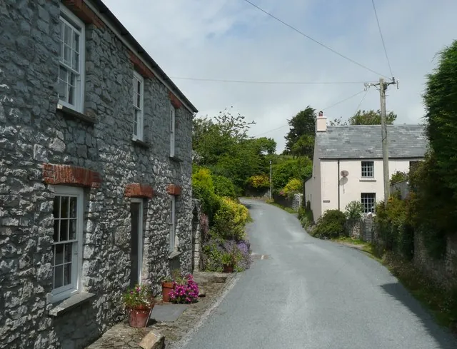
On the south coast of the county, inside the national park, Manorbier is a village, a community and a parish at once. The Welsh name, Maenorbŷr, means the ‘Manor of Pŷr’. The reason to make the trip is how tightly everything sits together: a Norman castle on one side of a small sandy bay, a 12th-century church on the other, a Neolithic burial chamber on the ground south of the beach, and the Wales Coast Path along the cliffs between them.
It is a small place, and worth saying so plainly. The community takes in Jameston, Lydstep and Manorbier Newton as well as the village itself, and the electoral ward of the same name — which stretches inland as far as St Florence — held 2,083 people at the 2011 census, so the village is a good deal smaller than that number implies. Only one rated attraction appears in the research for the whole village: the castle.
The straight-line distance from the centre point this guide measures from is 17.3 km. Wikipedia records that the area is served by the West Wales Line, stopping at Manorbier railway station.
Manorbier Castle carries 4.5 from 1,449 Google reviews. Two reviewers make the same practical point about arriving. One visitor set the route out in July 2026: “Park at beach car park, turn right and cross road into secret garden to gain entrance. Very limited parking otherwise.” Another that month noted that “the same car park serves both the castle and the beach, which is really convenient,” and treated the two as one outing.
Set the scale expectation before you go. That same visitor was straightforward about it: “Manorbier Castle isn’t one of the largest Welsh castles, especially when compared with places like Caernarfon Castle.” It is also a working events venue, which shapes what you find on the day — the first reviewer above arrived to find that “When we visited a huge tent was being erected in readiness for a wedding,” and mentions a cottage and private garden also available on the site, along with “fun pirate themed activities for children.”
Reviews are not uniformly warm. A visitor in August 2026 wrote, “Lovely location shame about staff. I hope we just caught them on a bad day.”
Wikipedia lists the sandy beach and the cliffs alongside the castle and St James’s Church as what draws people here. The geology is unusually legible: along the cliffs to the side of the beach, the rock formations are revealed as vertical beds. Fossils can be found along the stream bed, although Wikipedia is candid that some are of poor quality.
The prehistory is on the surface as well. The cromlech known as the King’s Quoit stands south of Manorbier bay and beach. Flint microliths from the Mesolithic and Neolithic ages are housed in local museums; a perforated mace head points to occupation of The Dak, and there are Bronze Age burial mounds on the Ridgeway. Fortification recurs: an Iron Age enclosure sits near Manorbier station, and at Old Castle Head is the site of a multivallate promontory fort — multiple ditches — with the remains of hut platforms inside them. East of the village, on the side of the road to Lydstep, strip lynchets survive from early Anglo-Saxon times and perhaps as early as the Bronze Age. Behind the castle, in Mud Lane, there is a well-restored lime kiln.
The Norman knight Odo de Barri was granted the lands of Manorbier, Penally and Begelly in gratitude for his military help in conquering Pembrokeshire after 1103. The first Manorbier Castle was motte and bailey; the stone walls were added in the next century by later Normans. St James’s parish church dates from the 12th century and is a Grade I listed building, and a large number of other buildings and structures in the parish are listed as well.
The village’s best-known son is Giraldus Cambrensis, Gerald of Wales, born here around 1146 and dying around 1223: a Cambro-Norman priest and historian, son of William de Barri, who called the place “the pleasantest place in Wales”. In late August 1908 Virginia Woolf stayed in Manorbier, by herself, at Sea View cottage, and worked there on her first novel, The Voyage Out.
From 1933 until 1 September 1946 a mixed civil and military airfield operated at Manorbier; during the Second World War it was a Royal Air Force station, RAF Manorbier. The site is now a firing range, employed by the Royal Artillery as a testing range for high-velocity missiles. Nothing in the sources behind this page sets out access arrangements, firing schedules, or any effect on walking routes nearby, so check locally before planning a walk in that direction.
Rail is the clean answer. Manorbier railway station is on the Pembroke Dock branch of the West Wales Line and is operated and managed by Transport for Wales Rail. It is a request stop, served every two hours each way — west to Pembroke Dock, eastwards to Tenby, Whitland, Carmarthen and Swansea. It is a request stop, so the train has to be signalled rather than waited for, and a two-hourly service means the return working shapes the visit.
For arrivals from further afield, Trainline names Haverfordwest as the county’s main station and Transport for Wales as the primary operator, with frequent daily services though fewer at weekends and on bank holidays. Most visitors from elsewhere in Wales and Britain change at Swansea, the far end of the same line Manorbier sits on.
Buses are the gap. The county’s Coastal Bus network meets the railway at Tenby, on routes 349 and 351, and at Pembroke Dock, on the Coastal Cruiser 387/388 — both of them stations on Manorbier’s own branch — but the transport research for this guide establishes no bus service to Manorbier itself, so plan on the train, the road or the coast path. One restriction applies across the national park: bikes cannot be carried on the Coastal Buses, so a bike-and-bus loop is not available.
On foot, part of the Wales Coast Path runs through Manorbier, which makes the village as much a waypoint on a longer walk as a destination.
The village and what is around it, at walking scale.
Open any of them in Google Maps for directions and current opening.
Attractions, prices and availability in Pembrokeshire
These come from GetYourGuide's booking widget, which sets their cookies in your browser. Consent to load it and see the attractions and prices.
Background on Manorbier draws on its Wikipedia article, text there being available under CC BY-SA 4.0.